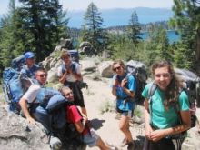
Planning a Lake Tahoe hike with children can be a challenge. But watching the kids scamper across a wildflower meadow and enjoying the great outdoors is worth the effort. Check out these Lake Tahoe kid-friendly hikes to take the guess work out of the planning.
Truckee
Glenshire Lake Trail
A quick 6-mile drive from downtown Truckee, this short, scenic hike is in the Glenshire subdivision. The 1-mile loop circles the small lake and crosses a lush meadow. The Glenshire Lake Trail is a nice wilderness adventure for the very young.
Getting there: From downtown, drive east on Donner Pass Road. Turn right at Glenshire Drive and continue 5 miles to the Glenshire clubhouse parking lot. The trail starts behind the clubhouse.
Martis Creek Lake
This is a very popular walk along the creek with no elevation gain; lots of folks use the path as a dog walk, so make sure the kids are prepared for furry activity. The lake is about 1 mile from the roadside gate, meandering through wetlands and along the creek side. Some days, glider planes are visible from the adjacent airport. Out-and-back is a gentle 2 miles, or choose to connect with the Tompkins Memorial Trail for a 3-mile loop.
Getting there: From downtown Truckee, drive east on Brockway Road from Donner Pass Road. At the junction with SR 267 turn right. After the airport turn right into the lot marked Wildlife Viewing Area.
Incline Village
Tahoe Meadows, Mt. Rose Highway
Called the Tahoe Meadows Whole Access Trail, this just over 1-mile loop through meadows and forested glades is suitable for wheelchairs and strollers. The entire trail has three bridges crossing over picturesque streams, and wildflowers are often abundant.
Getting there: From the junction of highways 28 and 431 in Incline Village, drive east on 431 (the Mt. Rose Highway) 7.7 miles to the right-side parking lot. The trail starts immediately in the lower lot and restrooms are available.
South Lake Tahoe
East Peak Trail, Heavenly Gondola
It’s a fact: Children love rides. All ages can enjoy a combination ride/hike after using the E Ticket gondola to float up to Heavenly’s hiking trails. The East Peak Trail is the most gentle choice, gaining 400 feet of elevation in a 1.6-mile roundtrip hike. The vista point offers stunning views of the Tahoe basin and the Carson Valley far below. The hike is at 9,100-foot elevation. It takes about an hour, and there are also 2.2-mile and 3.8-mile options for a sturdier crowd.
Getting there: In South Lake Tahoe, two blocks before the Stateline casinos, is the Heavenly Village Gondola Center. Parking is in back. There is a fee to ride the eight-person gondola, but children 4 and younger ride free. Midway up the ride is a 14,000-square-foot observation deck with snack shack and picnic tables.
Leaf Dam
All ages will enjoy this gentle stroll alongside the lake and through cool woods. A half-mile down the well-marked path, you’ll reach the dam built in 1934. There is a bridge across the spillway where you can watch the water cascade down Taylor Creek. Feel free to keep walking, as the trail continues along the lake for another half-mile with many choice spots for resting, picnics and swimming.
Getting there: Driving north on Highway 89 from South Lake Tahoe, turn left after 3 miles at Fallen Leaf Lake Road. A half-mile down, turn right at the campground then veer left for day visitors. Drive along to the parking area; the trail starts on the road’s left. When you reach the lake, the dam and trail head to the right.
Angora Lakes
The Angora Lakes area is a hike back in time with rustic old cabins dotting the shore and a lemonade stand to reward those making the half-mile trek. The trail is dirt and there is a bit of a climb from the parking lot, but once there families can buy lunch at the store or rent kayaks for some water time.
Getting there: From South Shore’s Highway 50/89 junction, drive 3 miles north on Highway 89, turning left at Fallen Leaf Lake Road. Turn left at Tahoe Mountain Road then drive a short distance before turning right at the Angora Ridge Road. Continue 3 miles until the road ends at the paved parking lot.
Rainbow Trail Stream Profile
For the very young, the stream profile at Taylor Creek is perfect — just a short walk from the parking lot then a chance to watch fish life from a glassed-in, underground chamber built along the river. The Rainbow Trail is mainly paved, and the 1-mile total loop swings by the stream profile before finishing up at the car park and nearby beach.
Getting there: From South Shore’s Highway 50/89 intersect, drive north on Highway 89 about 3 miles before turning right at the Lake Tahoe Visitor Center. Drive down the road to the parking lot; follow the signs for the Rainbow Trail.
West Shore
Emerald Bay
What child doesn’t want to see a castle? At Emerald Bay is historic Vikingsholm, an authentic reproduction of an 800 A.D. Norse castle built in 1929. There is a paved trail down, but for parents with strollers, beware, since you’ll be pushing it back up the steep hillside. The path is 2-miles roundtrip and has lovely Tahoe views and restful benches. Once there, half-hour castle tours are offered all summer. Find more information at www.vikingsholm.com.
Getting there: From South Lake Tahoe, drive north on Highway 89 for 9 miles, turning right into the well-marked Emerald Bay parking lot. There is a $3 fee to park, and the trail is easily visible.
Eagle Falls
Just across from the Emerald Bay parking lot is the lot and trail head to Upper and Lower Eagle Falls plus Eagle Lake and the Velma Lakes. The lower falls are visible from the lot, and a 1-mile hike down to the base allows youngsters a chance to see a waterfall up close. There are some stone steps, so strollers aren’t advised. Those wanting a longer hike can head 1 mile farther to Eagle Lake for a day of water play and picnicking.
Getting there: Nine miles up Highway 89 from South Shore or 20 miles south of Tahoe City, the parking lot is on the west side of the highway. There is a parking fee, and you must file a wilderness permit on site, which is free.
Rubicon Point & Lighthouse
This choice combines a hike with a chance to investigate a disused lighthouse from years gone by. It’s a total loop of 2.5 miles with only a 200-feet gain in elevation, but there are steps carved into the granite, which can be tiring for the very young. The hike offers wonderful views, but there are a couple sections of rock overlook where parents should keep close watch on the children.
Getting there: From Tahoe City, drive south on Highway 89 for 15.8 miles before turning left into the D.L. Bliss State Park. Continue driving 1 mile to the parking lot. The trailhead is on the left. Out and back to see the lighthouse (rather than the whole loop) is 1.5 miles.
What’s your favorite hiking with kids tip or spot? Let us know!


